
Floor Plans & Digital Documentation
Your building, clearly documented.
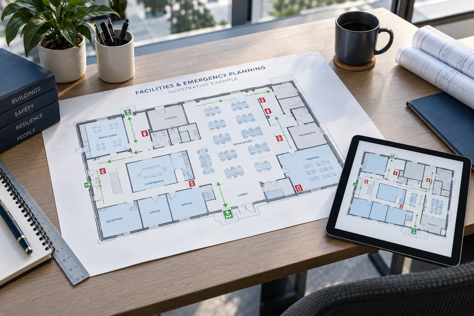
Measured floor plans, 3D virtual tours, and dimensional information for commercial and residential properties help your team plan work remotely. Add CAD drawings, Revit models, or specialized documentation when your project requires them.
Request a sample floor plan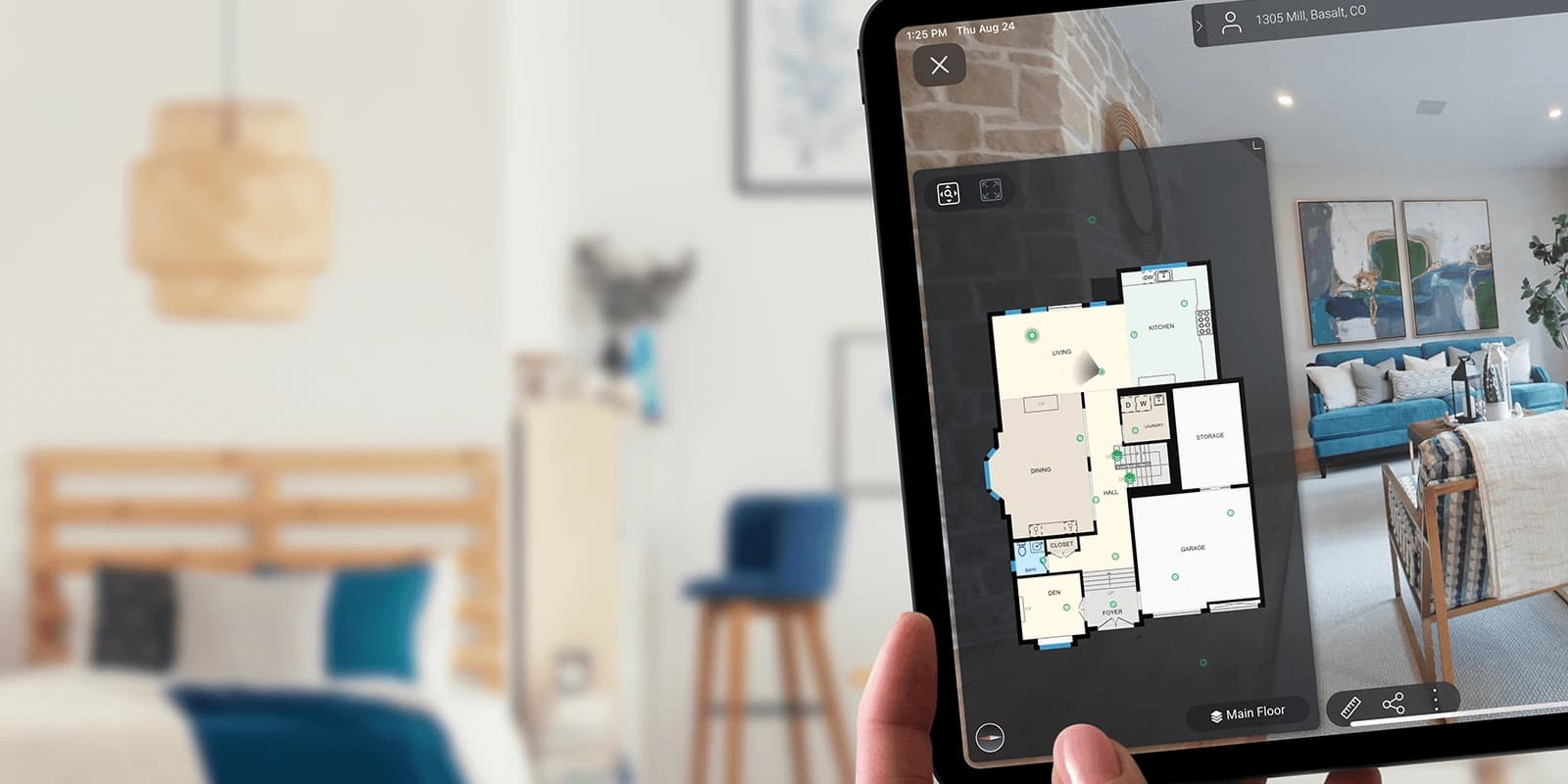
The problem we help solve
Outdated plans and repeated site visits slow down routine decisions. A measured layout paired with a virtual walkthrough helps people understand both the dimensions and the space around them.
Who it helps: Facilities teams, owners, real estate professionals, designers, and estimators.
What you receive—and why it matters
Useful deliverables, defined before capture.
We confirm the outputs, access, and level of detail in your project scope.
Measured floor plans
Review room layout and dimensions before planning a visit, estimating work, or coordinating a project.
Virtual walkthrough
Explore captured rooms remotely to see finishes, visible systems, and how spaces connect.
Tags and property details
Connect selected equipment or reference information to locations within the visual record.
Optional drawings and models
Choose editable DWG drawings, DXF point data, SVG plan graphics, or an RVT model for Revit when needed. Ceiling plans and exterior elevations require their own scope and additional processing.
In your workflow
Where your team puts it to work.
Facilities coordination
Help a vendor understand the space and identify what must be checked on site.
Design and estimating
Give designers and bidders the same existing-condition reference so they can compare room layouts, visible finishes, and scope assumptions.
Property marketing and handoff
Explain the building to prospective occupants and retain a useful record for future ownership.
Explore your deliverables.
Explore documentation for commercial and residential properties. Expand an item for outputs, uses, and technical details. Only site plans are currently limited to residential properties.
Floor plans & dimensionsUnderstand the layout, room sizes, and floor area.Core · scope confirmed
- What you receive
- A top-down drawing of captured rooms in commercial or residential properties, with agreed dimensions and floor-area information. A schematic plan explains layout; an as-built plan records existing conditions at capture rather than a proposed design. For applicable residential properties, our floor-area measurements meet ANSI Z765 standards.
- Uses & considerations
- Use it for space planning, insurance records, renovation discussions, and contractor estimating. Agree on measurement method, included spaces, and drawing detail; it is not automatically a permit or construction drawing.
Scope: Core record · scope confirmed.
Virtual tours & remote measurementsExplore captured spaces and reference dimensions from your desk.Core tour · measurements by scope
3D virtual property tour
- What you receive
- A navigable visual walkthrough for commercial or residential properties, linked to the building layout. Review rooms, finishes, visible equipment, and access from captured viewpoints.
- Uses & considerations
- Help vendors prepare, orient new staff, and revisit pre-loss or completed-project conditions. It represents the capture date, not a live view. Hosting duration and sharing arrangements are confirmed in your proposal.
Scope: Core record · scope confirmed.
On-screen and advanced measurements
- What you receive
- Reference horizontal distances on a plan or estimate horizontal and vertical dimensions within the tour. Advanced measurement can use matching points from multiple captured viewpoints.
- Uses & considerations
- Useful for preliminary estimating, maintenance planning, and project scoping. Results depend on capture coverage and point selection; all on-screen measurements are estimates. Verify critical dimensions on site before fabrication, ordering, or construction.
Scope: Scope-dependent functionality.
Equipment tags & documentationFind equipment details, photos, and notes by location.Scope-dependent
- What you receive
- Location-linked notes, photographs, and supporting files can identify HVAC units, electrical panels, shutoffs, mechanical equipment, or fire/life-safety components. Record available make, model, serial number, and maintenance notes.
- Uses & considerations
- Help staff find the correct asset and give contractors context. Agree on the asset list, information fields, access, and update owner. Tags record supplied or observed information; they do not certify equipment condition or replace a maintenance system.
Scope: Scope-dependent documentation.
Editable drawings & plan graphicsGive design teams usable files for their existing workflow.Optional / by request
CAD drawings: DWG and DXF
- What you receive
- DWG files for AutoCAD can be delivered as architectural floor plans drawn to LOD 200 (Level of Development). When specified in your scope, these include AIA-compliant layers, annotations, labels, area totals, and dimensions. Layers organize drawing elements so design teams can work with them more easily. A floor-plan DWG is a 2D drawing; a 3D DWG model is a separate deliverable. DXF is an exchange format that can carry captured point data for compatible software.
- Uses & considerations
- Give architects, engineers, and contractors a starting reference for renovation and design. Specify drafted drawings versus point data, layers, software version, and required detail. Wall thicknesses may use drafting assumptions; files are not automatically construction-ready.
Scope: Optional · additional processing.
SVG plan graphics
- What you receive
- SVG means scalable vector graphics: line-based artwork that stays sharp when resized. A plan in SVG format can support diagrams, presentations, and custom documentation layouts.
- Uses & considerations
- Confirm required content and editing workflow. A scalable graphic is not a Revit model or an engineering certification. Export details and any tag styling need to be checked for the project.
Scope: Available by request · scope-dependent.
Revit & 3D building modelsStart design coordination with a model of the building shell.Optional
- What you receive
- RVT is the project-file format used by Revit. A scoped 3D model can represent walls, doors, windows, and a basic building shell for architectural coordination.
- Uses & considerations
- BIM means building information modeling: a workflow using models and associated information. This deliverable can be a starting point for that workflow; it is not automatically a fully detailed building-services model. Agree on elements, detail, software version, and intended use.
Scope: Optional · additional modeling.
Reflected ceiling plansSee agreed lighting, ceiling heights, and overhead features.Optional
- What you receive
- A reflected ceiling plan, or RCP, maps overhead features in alignment with the floor plan. A scoped DWG can show lighting locations, bulkheads, and ceiling-height indicators.
- Uses & considerations
- Help designers and facilities teams plan ceiling work. Confirm visible mechanical components, sprinklers, and other fixtures individually; do not assume every system or concealed service is included.
Scope: Optional · additional drafting.
Exterior elevation drawingsReview flat drawings of the building’s outside faces.Optional
- What you receive
- Flat drawings of the building’s front, rear, and sides, supplied as scoped DWG files. They help teams understand the façade for renovation planning and architectural reference.
- Uses & considerations
- Request elevations before capture: additional exterior scan coverage is needed. Site access, visibility, and building complexity affect scope. Pair drawings with dated photographs when exterior condition documentation is required.
Scope: Optional · additional capture and drafting.
Residential site plansSee the home and outdoor spaces alongside a virtual tour.Residential only · by scope
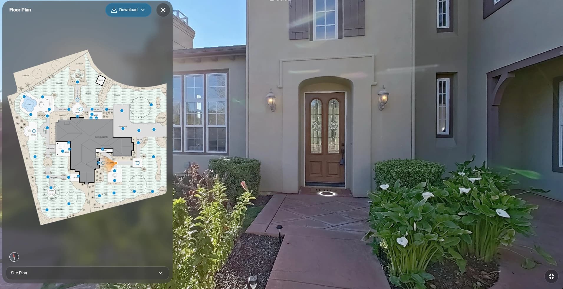
- What you receive
- A site plan provides outdoor property context alongside a residential virtual tour, helping viewers understand how the home and captured outdoor spaces relate to one another.
- Uses & considerations
- Useful for realtors presenting a property and homeowners exploring its layout remotely. Site plans are currently available for residential properties only. Confirm inclusion, capture coverage, and required detail before ordering.
Scope: Residential only · scope-dependent.
Your proposal confirms included deliverables, selected options, and access terms. Core items are included only where specified in your scope.
Documentation in practice
Move from a visual view to a measured plan.
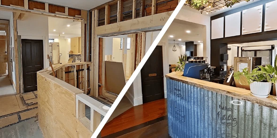
Walkthroughs explain the space. Floor plans organize its dimensions and relationships. Each makes the other more useful.
See more examples ↗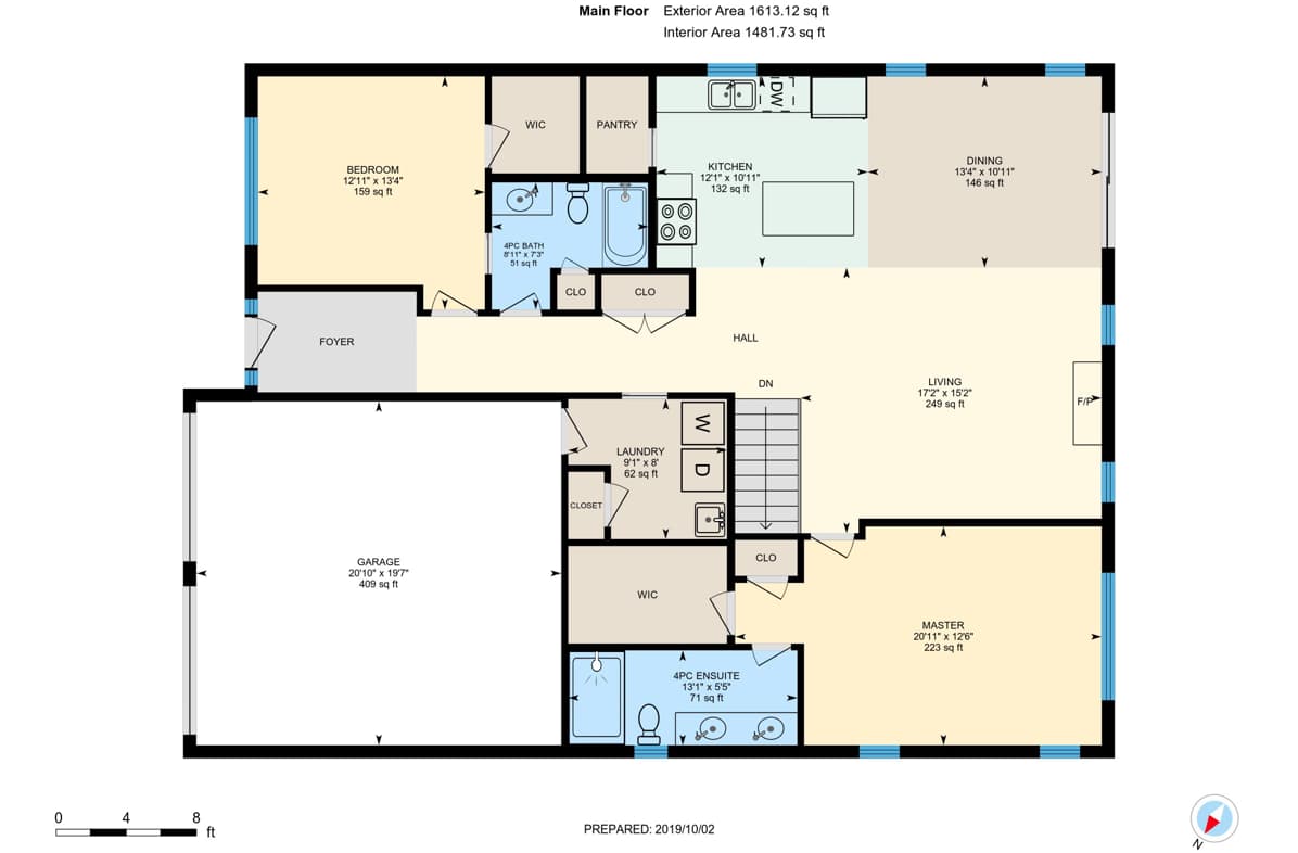
From first conversation to handoff
How this project takes shape.
Confirm the output
Discuss area, access, intended use, and required file formats or level of detail.
Capture the spaces
Arrange access and document the agreed rooms and visible details.
Deliver the record
Review plans and walkthrough access, sharing needs, and any scoped optional outputs.
Before you decide
Common questions about this service.
Can I order floor plans as a standalone service?
Yes. Property Floor Plans & Digital Documentation can be commissioned independently of a Safeguard Property Profile. We will confirm the capture scope and required file formats before work begins.
Can the files be used in our design workflow?
Tell us which software, formats, and measurement requirements your team uses. CAD and model deliverables are optional and must be confirmed in the proposal; not every format is part of the base scope.
Will this eliminate every site visit?
No. Remote review can reduce unnecessary return visits, but hidden conditions, precise tolerances, and changes after capture still need appropriate field verification.
What is included in a digital property documentation package?
Your proposal lists the included spaces, floor plans, dimensional information, tour access, and any selected property details. These form the core record where contracted. Tags, exports, CAD drawings, models, ceiling plans, and elevations must be identified explicitly; every available output is not automatically included.
How accurate are the floor plans and measurements?
For applicable residential properties, our floor-area measurements meet ANSI Z765 standards for measuring and reporting residential square footage. ANSI compliance describes the measurement and reporting method; it is not a blanket accuracy guarantee for every room dimension or on-screen measurement. Tell us your property type, intended use, and required tolerance so we can confirm the appropriate specification. Tour measurements remain estimates, and critical dimensions require on-site verification.
Can contractors take measurements from the virtual tour?
Yes, when measurement functionality is enabled in the agreed tour. Horizontal, vertical, and multiple-viewpoint estimates can help prepare a scope. Coverage and viewpoint selection affect results. Critical dimensions must be measured on site.
Can I receive CAD, DWG, DXF, or SVG files?
Yes. Discuss the required output before capture. A drafted DWG, DXF point data, and SVG plan graphic serve different purposes. Confirm file contents, layers, software compatibility, and any additional processing in the proposal.
Can you provide a Revit model?
Yes. ForeFront360 can scope an RVT model or a 3D DWG for a building-shell reference. It is separate from a navigable tour and a 2D floor plan. Your design team should specify the modeled elements, level of detail, software version, and verification requirements.
How long can we access the property information?
Tour hosting, renewal terms, permitted sharing, downloads, and file retention are confirmed in your ForeFront360 proposal. Do not assume indefinite hosting. We can discuss downloadable plans and available offline-viewing options for your handoff requirements.
Related solutions
Build on this documentation.
Start with a conversation
Ready to define a useful scope?
Tell us about the property and the decisions you need to make. We’ll help identify the right deliverables.