Facilities & Emergency Planning
Give your team a better picture of the place they protect.
Connect building layouts, visual records, and key equipment information so facilities and planning teams can work from shared context.
Discuss your facilities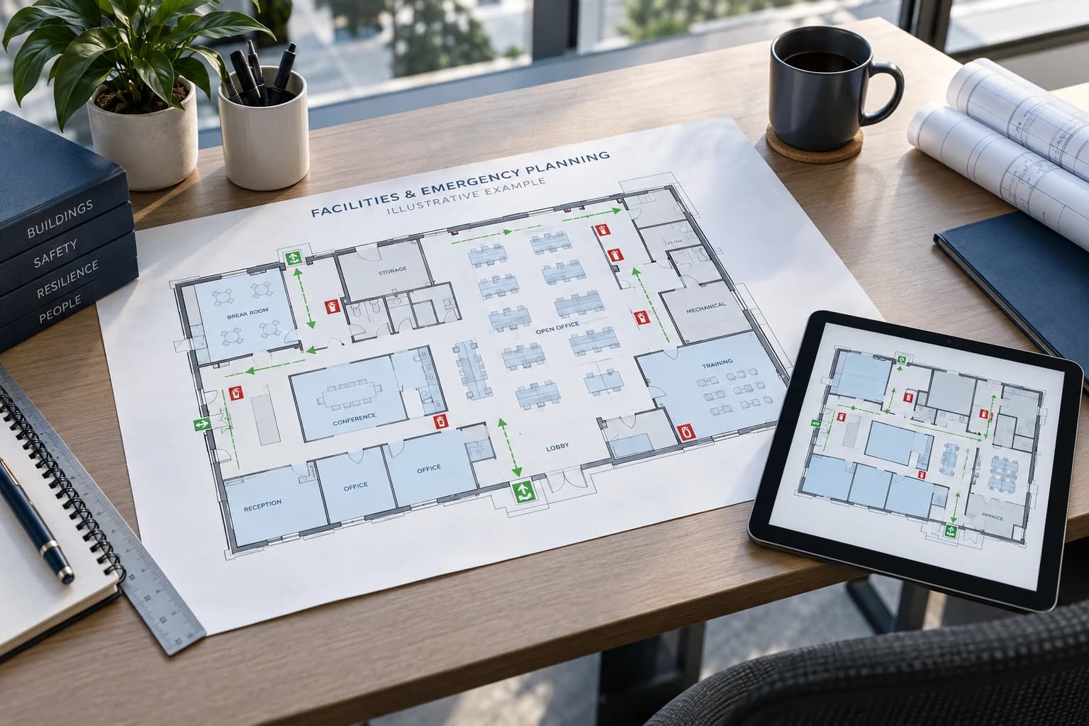
The problem we help solve
When building knowledge lives with a few people, even a routine maintenance task can involve searching rooms, old binders, and email threads. Organized visual records help the next person find the right place and ask better questions.
Who it helps: Facilities directors, school and campus administrators, municipal teams, and nonprofit facility leaders.
What you receive—and why it matters
Useful deliverables, defined before capture.
We confirm the outputs, access, and level of detail in your project scope.
Building layouts and visual context
Orient staff, contractors, and planning teams before a walkthrough or maintenance visit.
Location-linked equipment records
Scope tags for HVAC, electrical panels, shutoffs, and visible fire/life-safety equipment. Connect available label images, identifiers, and maintenance notes to the correct location; agree on the asset list before capture.
Planning maps
Discuss maintenance, shutoff, evacuation, or emergency-equipment mapping with the responsible facilities and response teams.
An organized handoff
Agree on naming, permitted access, and update responsibilities so information remains useful as staff and buildings change.
In your workflow
Where your team puts it to work.
Roof and grounds review
An optional Aerial Imaging Report (AIR) adds available roof, vegetation, and surface context to maintenance and capital-planning discussions.
Maintenance and vendor coordination
Locate systems and review their surroundings before organizing work.
Staff transition
Help incoming team members inherit building knowledge instead of starting from scratch.
Preparedness planning
Give authorized teams shared layout context for exercises and planning, subject to site verification and professional review.
Explore your deliverables.
Explore documentation for commercial and residential properties. Expand an item for outputs, uses, and technical details. Only site plans are currently limited to residential properties.
Remote measurementsReference dimensions remotely for preliminary planning.Scope-dependent
- What you receive
- Reference horizontal distances on a plan or estimate horizontal and vertical dimensions within the tour. Advanced measurement can use matching points from multiple captured viewpoints.
- Uses & considerations
- Useful for preliminary estimating, maintenance planning, and project scoping. Results depend on capture coverage and point selection; all on-screen measurements are estimates. Verify critical dimensions on site before fabrication, ordering, or construction.
Scope: Scope-dependent functionality.
Equipment tags & documentationFind equipment details, photos, and notes by location.Scope-dependent
- What you receive
- Location-linked notes, photographs, and supporting files can identify HVAC units, electrical panels, shutoffs, mechanical equipment, or fire/life-safety components. Record available make, model, serial number, and maintenance notes.
- Uses & considerations
- Help staff find the correct asset and give contractors context. Agree on the asset list, information fields, access, and update owner. Tags record supplied or observed information; they do not certify equipment condition or replace a maintenance system.
Scope: Scope-dependent documentation.
Reflected ceiling plansSee agreed lighting, ceiling heights, and overhead features.Optional
- What you receive
- A reflected ceiling plan, or RCP, maps overhead features in alignment with the floor plan. A scoped DWG can show lighting locations, bulkheads, and ceiling-height indicators.
- Uses & considerations
- Help designers and facilities teams plan ceiling work. Confirm visible mechanical components, sprinklers, and other fixtures individually; do not assume every system or concealed service is included.
Scope: Optional · additional drafting.
Your proposal confirms included deliverables, selected options, and access terms. Core items are included only where specified in your scope.
Documentation in practice
Make important locations easier to find.
Equipment mapping can connect a building layout to critical systems. Examples support planning and require review and ongoing updates by responsible site teams.
See more examples ↗From first conversation to handoff
How this project takes shape.
Prioritize the use cases
Choose the systems, locations, and staff workflows the record should support.
Document and map
Capture agreed spaces and references while following the site’s access and security requirements.
Review with responsible teams
Confirm accuracy, controlled sharing, and a process for keeping maps current.
Before you decide
Common questions about this service.
Do maps replace emergency plans or on-site verification?
No. Maps support planning and must be reviewed with the responsible facilities and emergency-response teams. Site conditions, equipment locations, and procedures should be verified and kept current.
Can we include several buildings?
Yes. Start with a representative building to agree on naming, outputs, and responsibilities, then plan the remaining locations.
Can this help a new technician prepare for a visit?
Yes. Where included, location-linked equipment details and label photographs help a technician identify the asset and review its surroundings before arrival. Confirm current conditions and service requirements on site.
Should emergency maps be public?
Access should be agreed with the responsible organization. Sensitive systems and security details should be shared only through approved channels with authorized people.
Can equipment and building systems be tagged?
Yes. Scoped tags can connect equipment locations to available label photographs, identifiers, notes, and supporting files. We agree on which assets and fields to document. These records support maintenance and orientation; they are not equipment inspections or automatic service tracking.
Can you provide ceiling plans and exterior elevations?
Yes, as separately scoped outputs. A reflected ceiling plan documents agreed overhead features. Exterior elevations show building façades and require planned exterior capture. Both need additional drafting; access and capture requirements should be confirmed before the visit.
How long can we access the property information?
Tour hosting, renewal terms, permitted sharing, downloads, and file retention are confirmed in your ForeFront360 proposal. Do not assume indefinite hosting. We can discuss downloadable plans and available offline-viewing options for your handoff requirements.
Related solutions
Build on this documentation.

Start with a conversation
Ready to define a useful scope?
Tell us about the property and the decisions you need to make. We’ll help identify the right deliverables.